Sydney Rain Radar: A Boater's Guide
Quick summary
Sydney radar covers Botany Bay, Port Jackson and the NSW coast to about 200km offshore on the 512km sweep.
The 128km loop refreshes every 6 minutes and gives the best resolution for tracking fast-moving squalls into the harbour.
What to do with it
Use the 128km loop for day trips; switch to 512km when planning offshore runs beyond the continental shelf.
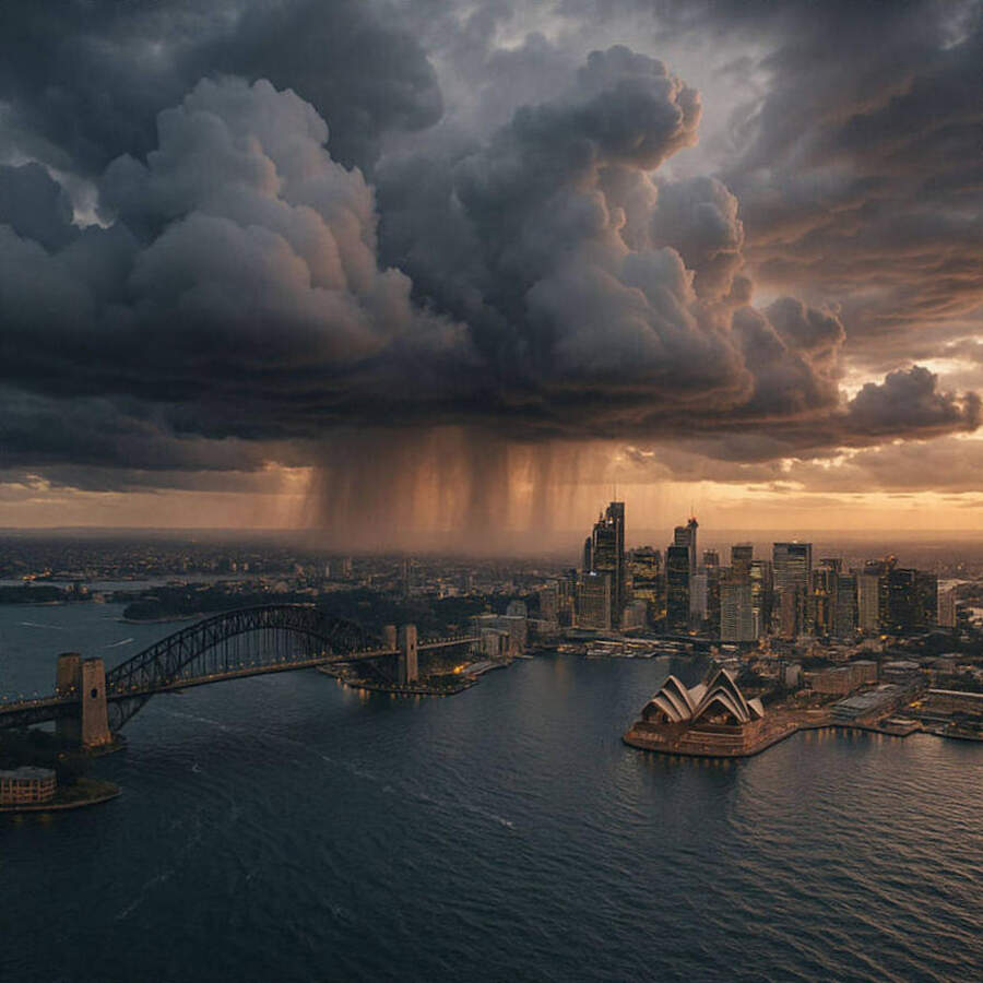
Sydney sits in one of Australia's most dynamic coastal weather zones, where cold fronts, east coast lows and sea breezes can all produce rapid changes in conditions.
The Seabreeze Sydney radar pulls its data from the Bureau of Meteorology's Terrey Hills installation, about 35km northwest of the CBD — the same site that feeds the official BOM radar app.
Understanding the two sweep ranges
The 128km sweep covers from the Hawkesbury River down past Wollongong, reaching about 50km offshore.
This range is ideal for picking up cells tracking in from the south or northwest that will affect the harbour, Botany Bay and the northern beaches within the next 30-60 minutes.
The 512km sweep extends to the continental shelf and beyond, useful for tracking fronts and lows while you're planning an offshore trip the next day.
Both loops update every 6 minutes, so a full picture of storm movement builds quickly after a few frames.
Reading the colours
Radar returns use a consistent colour scale across all Australian installations.
Light blue and green represent light rain — 0.5mm/hr or less — typically from stratiform cloud or light showers passing through.
Yellow and orange indicate moderate rain, 5-20mm/hr, where small vessel conditions start to deteriorate rapidly in open water.
"A yellow cell over the open Tasman can move 40-50km in an hour — if you're 20 miles offshore and a cell is at your 12 o'clock, you have 25-35 minutes."
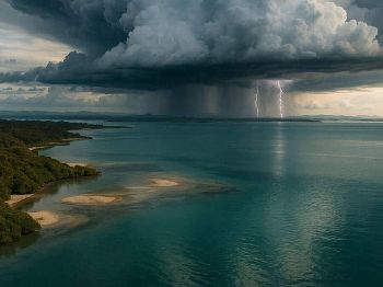
Red and purple cores signal heavy to extreme precipitation, 50mm/hr and above, with embedded lightning risk in convective cells.
Sydney's common hazard patterns
Southerly busters arrive as a sharp line echo moving northwest up the coast, often preceded by a brief northwesterly blast and then a sudden wind shift of 30+ knots.
On radar they appear as a defined arc of green-yellow returns tracking northward at 20-40km/hr — give them a wide berth if you're near the heads.
Afternoon sea-breeze thunderstorms typically initiate over the Blue Mountains between noon and 2pm in summer, tracking northeast toward the coast.
Watch for isolated returns developing west of Penrith on the 128km loop — they can reach the coast within 90 minutes under typical summer flow.
East coast lows generate diffuse, wide-area rainfall that can persist for days; the radar will show a broad envelope of green-blue returns rotating around a centre just offshore.
How to use radar before launching
Open the radar loop at least 30 minutes before departure and run at least 8-10 frames to establish storm movement direction and speed.
A cell that has moved 15km in 6 frames is travelling at 150km/hr — rare, but it happens with supercell events.
Most day-trip squalls over the harbour travel at 20-30km/hr, giving 15-30 minutes of warning from first appearance on the 128km loop.
Check the NSW coastal warnings alongside the radar — if a warning is active, radar cell movement tells you when the worst will hit your location.
Gaps in radar coverage
The Terrey Hills radar has a cone of silence directly above the antenna site and a terrain shadow toward the northeast, roughly in the direction of the Central Coast.
For trips to Broken Bay and the Hawkesbury, the Newcastle radar at Kurnell provides a useful cross-check from the north.
Common questions
Why does the radar sometimes show returns with no rain falling? Anomalous propagation (AP) occurs when temperature inversions bend the radar beam back to the surface — you get ground clutter returns that look like rain but aren't.
How far ahead can I plan using radar alone? Radar is a now-casting tool; it tells you where rain is, not where it will be in 6 hours.
Can I see lightning on the radar? Standard BOM radar does not show lightning directly; use a dedicated lightning tracking service alongside radar for storm cells.
Track current Sydney conditions via the Seabreeze Sydney rain radar before every trip.