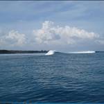
I was checking sea surface obs when I saw something of interest emerging from QLD heading toward NSW.The area of interest is the 24-28 degree water .Is that what they call the morning glory.![]()
www.weatherzone.com.au/climate/indicator_sst.jsp?lt=wzstate&lc=nsw&c=sst
I tried to paste the image but it wouldn't work.click on the link and you might see what I mean
here you go Loch ![]()
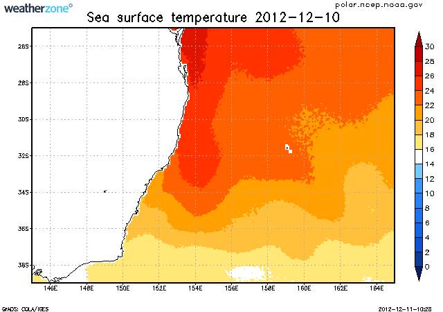
The sea surface temperature (SST) varies much more slowly than atmospheric temperatures due to the heat capacity of water. As such, the SSTs lag the atmospheric temperatures on a seasonal timescale by about 3 months. The lowest SSTs are usually observed in early Spring and the highest SSTs are observed in early Autumn.
In tropical regions, SSTs greater than 26°C are considered suitable for formation of tropical cyclones.
The data displayed in this map is the weekly average, centred on the date shown.
used to work with a guy whose nickname was "cylone"......
he was a slow moving depression