Cyclone Yasi is brewing and may hit Cairns as a Category 4 (out of possible 5)
Winds may be in excess of 100 knots .. ouch. ![]()
Beaufort scale describes them as "Very rarely experienced - widespread damage",
View the tracking map, warnings, and satellite images all in one spot:
www.seabreeze.com.au/graphs/qld_cyclone.asp
Hi Laurie,
Yasi is already a high Cat 4 atm and due to intensify, sucking everything around her in.
All coastal areas between Cooktown and Mackay will experience damaging winds, floods, around 100mm of rain.
JTWC is forecasting 150knts when Yasi hits land. 
Yasi will most likely hit between Innisfail and Ingham. Therefore, strongest winds to be expected on the southern end of system in Townsville region. We going to have high tides and an expected storm surge of 4-5m.
We are packing and leaving our house on beach tomorrow morning if things stay as they are now!
This will be the biggest Cyclone this country has ever experienced.
Bless all people up here, stay safe!
Peace*
yeah its lookin rather nasty .........
you poor Queenslanders just cant get a break at the moment its one thing after another.
Good luck to all those in her path, stay safe and look out for others.
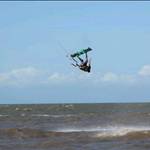
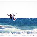
Anyone know what the strongest kited wind known is. 100 kt wind=2m kite. Surly not.
... cyclone Tracy made a mess of our place when I was a kid (5 yr old then) Christmas day and changed many lives, so cat 4 or 5 is no joke, it really is going to be hard core! I think Tracy was the most distructive cyclone to hit Oz, til now!!
But there is some cold comfort, they have on us back then, now-a-days you have modern technology and better designs and materials compared to 1974.
Some of the amazing facts that I still marvel at is the wind gauge at Darwin Airport officially recorded winds of 217 kilometres per hour before being blown away itself, and it was a category 4 storm whilst still out at sea, but there are suggestions that it was category 5 when it made landfall.
No wonder all my Christmas toys dissappeared. I have a vivid memory while huddling under a mattress in a build in cubboard, moments before the roof disappeared and we ran into our bathroom which was the only part of the house that had part of the roof still on, as a flash of lightning lit up the sky I saw the next door neighbours 16 foot tinny with an old school 40 horse outboard attached fly past the window and land in our lounge room wall like it was an arrow! We had only 4 walls still up at the end of it and they were the walls of the room we were in. We couldn't get out the next day because the other walls had collapsed on the doors and windows so we were stuck in there until some neighbours got us out.
Yep, if you have something like this coming, get out of Dodge!
Good luck IntheLoop, our thoughts are with you!
cheers,
Robbie
Latest Updates:
"Tropical Cyclone Yasi could become a category five monster packing 300kmh winds by the time it crosses the Queensland coast, the weather bureau has warned.
Latest Bureau of Meteorology modelling shows Yasi making landfall at Cairns early on Thursday morning as one of the likely scenarios.
Authorities doorknocking homes in north Queensland are now ordering people to leave their properties, amid fears Yasi will cause a two-metre storm surge."
Gees, Sucks to be a Queenslander this summer ![]()
Real "end of days" type stuff, best of luck everyone, Hope you all make it through well and quickly.
We're all thinking of you.
CRIKEY!
DM
To put it into perspective, hurricane katrina caused an insane amount of damage and that was 650km's big, this is 500km and potentially growing. Estimate 1000mm of rain with it as well. You'd be overpowered if you tied your girlfriend's g-string to 5m lines and tried to kite with it.
Good luck guys! you're really copping it this year hope everyone prepares and is safe when it hits ![]()
This is the current wind record off QLD coast - except the wind meter must have been blown off - the last reading was 100 knots:
www.bom.gov.au/products/IDQ60801/IDQ60801.94299.shtml
This one may be the next one to go:
www.bom.gov.au/products/IDQ60801/IDQ60801.94290.shtml
Look at the barometric pressure too - 937.9 hpa - this must have been really close to the centre.
Edit:
Central Pressure of cyclone Yasi: 922 hpa