I wouldn't want to be on a Sydney mooring that is exposed to southerlies this Friday. Looks like we are going to get a blow.
I'm always surprised at how choppy it gets on the Harbour. The bottom end of Pittwater is bad enough in a good Northerly,
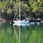
Thank goodness I'm moored up in the Creek, best mooring in the entire Universe.
The Creek is very good. I'm thinking of moving there now the road from Terrey Hills has been resurfaced.
What is it with the Seabreeze wind predictions? 36 kts for Friday and over 30 from 5:30 to 8pm it says. Bom wind prediction shows 15 to 25 kts inshore and up to 30 further out for maybe two hours. Bom Sydney forecast States up to 55 kph. Why is Seabreeze always giving such high predictions? Grrr...
Not sure where you got that Rog. Current BOM local and inshore forecast for tomorrow is:
"Southwesterly 20 to 30 knots shifting south to southeasterly at 30 to 40 knots during the morning."
Closed water:
"West to southwesterly 15 to 20 knots increasing to 25 to 30 knots during the morning, locally reaching 35 knots."
Local effects, such as a venturi effect between two bits of land could see the actual wind a bit higher. My Pittwater mooring gets a strong local effect in sou westers where it funnels between Church Pt and Scotland Is.
The BOM in my experience is more conservative (S2H 1998 influence maybe) but I have found the BOM are pretty accurate nowadays compared to the early 2000s.
It must have changed in the hour between us looking at the site. Where was your original information from MB?
Sea breeze had over 35kts for tomorrow in yesterday's forecast. A check of the BOM synoptic chart to confirm it had me thinking through how I secured MB last weekend.
After 1998 BOM were seriously over egging wind speed. If they said 20 expect 10, their 30 was often 15-20. Not now from my experience. A 15 forecast usually sees 15 to 20 which is reasonable.
I expect their afternoon update caught up with the developing low.
Yes, I think BOM have been on the mark for the last few years.
I always go here first:- www.bom.gov.au/australia/charts/4day_col.shtml
and then here to get my local forecast:- www.bom.gov.au/qld/forecasts/capricornia-coast.shtml
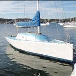
MB. If you move to the Creek will you use your sisters mooring near Browns Bay??.
Select to expand quotecisco said..
Yes, I think BOM have been on the mark for the last few years.
I always go here first:- www.bom.gov.au/australia/charts/4day_col.shtml
and then here to get my local forecast:- www.bom.gov.au/qld/forecasts/capricornia-coast.shtml
Synoptic charts - And here I was relying on pretty coloured arrows and text forecasts! ![]() Shall have to brush up on my high school geography.
Shall have to brush up on my high school geography.
Port Botany closed to shipping due to high wind.
You can get near real time reports from the BOM Doppler wind radar:
'www.bom.gov.au/products/IDR71I.loop.shtml#skip
I find the Latest Observations page really handy to track and try to time, forecast fronts, this one for all of N.S.W. allows you to keep track of any fronts with west in them:
www.bom.gov.au/nsw/observations/nswall.shtml
This one is coastal obs only:
www.bom.gov.au/nsw/observations/coastal.shtml
I have thought of that samsturdy. I couldn't use it permanently as Mischief is on it when not cruising but I have thought of 'borrowing' it.