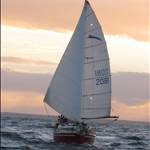
I will be on delivery passage late this month and interested to have some coastal waypoints in my handheld gps72 for reference along the way.
These will not be used for navigation an on board gps will be used for that but rather something to pass the time and get a feel for the landmarks , distances and harbours along the coast from Port Phillip Heads to Wide Bay Bar.
I can compile my own but i am hoping someone may have recorded them on a previous passage along the coast.
I can convert any format , check and upload easily using GE & oziexplorer.
I will record the track and post it when complete.
Hello i find it unusual you are asking for someone else way point when you are doing the voyage and navigating for your trip.
Are you not completing a passage plan your self !,where do want to stop? ,take shelter ?,take on more food ?, etc etc.
I have just completed a delivery from Melb to Qld. I did waypoints for the trip but due to the weather we ducked into ports for shelter which put us away from the plotted course ,also we stayed close to shore to gain current nth thus we adjusted our passage plan and waypoints.
Plot
Heads to Cape schank -Wilsons Prom-Gabo Island- Cape Howe-Point Perpendicular -Broken Bay-Sugarloaf point- Smokey Cape-Cape Byron-Point Danger- Surfers .
Are you going inside Moreton Island or out side ?
Also are you going inside fraser Island or around double island point !
Select to expand quotespiggie said..
Hello i find it unusual you are asking for someone else way point when you are doing the voyage and navigating for your trip.
Are you not completing a passage plan your self !,where do want to stop? ,take shelter ?,take on more food ?, etc etc.
I have just completed a delivery from Melb to Qld. I did waypoints for the trip but due to the weather we ducked into ports for shelter which put us away from the plotted course ,also we stayed close to shore to gain current nth thus we adjusted our passage plan and waypoints.
Plot
Heads to Cape schank -Wilsons Prom-Gabo Island- Cape Howe-Point Perpendicular -Broken Bay-Sugarloaf point- Smokey Cape-Cape Byron-Point Danger- Surfers .
Are you going inside Moreton Island or out side ?
Also are you going inside fraser Island or around double island point !
Thanks spiggie i am not navigating and not preparing a passage plan , i would have thought my post explained my purpose for the request fairly clearly
"These will not be used for navigation an on board gps will be used for that but rather something to pass the time and get a feel for the landmarks , distances and harbours along the coast from Port Phillip Heads to Wide Bay Bar."
I have plenty of experience with navigation on my own boat and understand many of the permutations of passage making , i simply asked if anyone was capable of sharing some waypoints , something i have done on occasion with waypoints i have created for waters i am familiar with.
This will be only my second delivery passage but look forward to many more along with some ocean racing and ORCV training as well , i am keen to build experience and becoming familiar with the east coast and having a few waypoints would assist in this.
If i was the navigator / skipper for the delivery i would not be relying on waypoints from someone / anyone from a forum surely no one is that stupid.
So if you have any waypoints i would be interested to try them.
Hi MM, You may be interested in plotting lighthouses along your route. If you end up doing coastal races you will also have to carry a list onboard of lighthouses along route.
It will give you an idea of how far, and in what conditions, that you can see the Loom, then the light, Wikipedia has a list of Australian Lighthouses and their Lat / Lon.
Just click on name of lighthouse, then on the right hand side of the new page, it has info containing range and characteristics.
en.wikipedia.org/wiki/List_of_lighthouses_and_lightvessels_in_Australia
Enjoy your trip.
Morningsun what a great idea , i will certainly waypoint them , they will be especially interesting on the night watch.
Thanks to spiggie for his list and his passage plan it helps to see how others prepare for similar trips.