El Niño Meets IOD: Your Season Outlook
In short
The Niño3.4 index crossed +0.81°C on 7 June 2026, just above El Niño threshold, while the Indian Ocean Dipole sits neutral but is forecast to shift positive by mid-winter.
The combined El Niño and positive IOD signal historically means drier, warmer winters for eastern Australia, fewer cold fronts from August, and above-average salinity in estuaries.
What to watch
June and July carry elevated Southern Ocean swell as a low-pressure belt persists south of the continent, so expect windows rather than settled stretches until August.
Two of the biggest drivers in Australian climate are aligning at the same time for the first time since 2023-24, and the combination carries specific implications for every skipper, fisher, and surfer planning the next six months on the water.
The Bureau of Meteorology reported the relative Niño3.4 index at +0.81°C for the week ending 7 June 2026, just clearing the El Niño threshold of +0.80°C.
The 30-day Southern Oscillation Index sat at -21.7 at the same time, firmly in El Niño territory.
All models the Bureau is running forecast the tropical Pacific to continue warming through winter and spring, meaning the signal is unlikely to reverse before summer.
The Indian Ocean layer
The Indian Ocean Dipole sits neutral at -0.34°C as of 7 June, but models are not staying quiet.
Most long-range guidance is pointing to a positive IOD developing during mid-to-late winter, per Bureau monitoring data.
A positive IOD amplifies El Niño's footprint on Australian weather, with cooler-than-average water in the tropical eastern Indian Ocean shutting off moisture that would otherwise feed frontal rainfall across the southeast.
Ashleigh Madden, Head Communications Meteorologist at DTN APAC (Weatherzone), presented the combined winter-spring outlook at the Australasian Marine Pilots Institute conference in Darwin on 14 June 2026.
DTN APAC's seasonal analysis flags the below-average pressure belt south and southeast of Australia as the key driver keeping swell energy above average through June and July, with flow-on effects for east and south-facing coasts until August when the high-pressure pattern becomes dominant.
The 1997-98 and 2023-24 seasons are the closest historical analogues, both combining a positive IOD with El Niño, and both producing significantly drier conditions for the NSW and Queensland coasts.
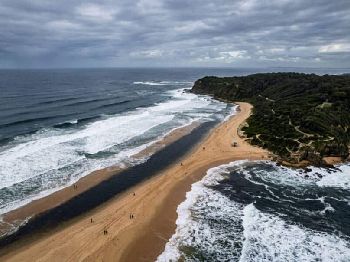
June and July: elevated swell, watch the windows
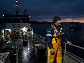
The news for offshore operators through June and July is not simply settled and calm.
A belt of below-average pressure is persisting to the south and southeast of the continent, acting as a swell generator across the Southern Ocean.
South and southeast-facing coasts from Tasmania through Victoria and into southern NSW will see above-average swell energy through these months as that pressure system maintains fetch.
Bar crossings on south-facing entrances carry above-normal risk through July, with swell periods likely to be longer than the wave heights alone suggest.
Offshore windows will exist but they will be brief, arriving behind individual fronts rather than as extended settled runs.
August shift: high pressure takes over
The picture changes around August as the broader high-pressure pattern associated with El Niño builds over and north of the continent.
South coast swell is expected to ease as the southern low-pressure belt weakens.
The east coast transitions toward a predominant easterly swell under a strengthened Tasman High, with lighter offshore winds on mornings that will be welcome for small-boat fishers heading to the shelf.
Cold outbreaks will be less frequent and less intense through August and September than a neutral-ENSO winter typically delivers, which is good news for trailer-boat operators who lose too many weekends to southerly busters.
Spring: swell resurgence on the cards
Forecasters are flagging a potential swell resurgence in spring when El Niño's correlation with a negative Southern Annular Mode (SAM) kicks in.
A negative SAM pushes the Southern Ocean storm track north, generating renewed swell energy across southern and eastern coasts from September onward.
Spring planning windows may be narrower than El Niño's drier reputation suggests, particularly for Bass Strait crossings and south coast bar ports where that swell energy translates most directly into hazardous conditions.

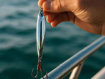
What it means for fishing
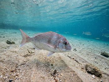
Sea surface temperatures off NSW and eastern Tasmania are already running 3-4°C above the seasonal average.
Pelagic species - mahi-mahi, yellowfin tuna, striped marlin - have been holding in waters closer to the coast than normal for this time of year, a direct result of warm Tasman current water pushing inshore.
Below-average rainfall forecast through winter will reduce freshwater inflow into estuaries, pushing salinity levels up in river mouths, bays, and tidal flats across the NSW and Queensland coasts.
Higher estuary salinity concentrates bream and flathead into deeper, saltier sections of river systems through winter, and the pattern tends to sharpen during July and August when flow rates are lowest.
Snapper on inshore reefs and ledges have responded well to warm El Niño years historically, with the fish holding shallower longer before the winter cold-water push forces them into deeper structure.
Cyclone season and the north
El Niño years reliably suppress tropical cyclone activity in the Australian region.
The Bureau's historical data shows El Niño seasons produce below-average cyclone numbers across the Australian region, with reduced intensity and a delayed peak compared to neutral or La Niña years.
For north Queensland and NT boaters, lighter trade winds and reduced swell energy are the headline seasonal pattern, with more settled conditions across northern waters through winter and into the early wet season.
The delayed monsoon onset that typically accompanies El Niño will push the wet season start date later, extending the dry-season fishing and cruising window across northern Australia.
Planning your season
The IOD outcome is still uncertain - models show a wide range of timing and intensity scenarios - and individual weather systems will still create hazardous periods regardless of the seasonal tendency.
A high-pressure-dominated season does not mean an absence of gales, particularly through June and July when the Southern Ocean remains active.
The practical takeaway: the seasonal pattern favours offshore opportunities in August and September for south and east coast operators, estuaries will fish well through July as salinity concentrates prey species, and the northern dry season window may run longer than usual.
Track updated outlooks via Seabreeze wind forecasts and Seabreeze warnings as the season develops.
Common questions
Will El Niño mean fewer surf days in winter? Not necessarily in June-July: the Southern Ocean remains active and south swell energy is above average through this period. August and September lean toward lighter conditions on south-facing coasts.
Does warm water mean better offshore fishing? For pelagic species, yes - the warm Tasman SSTs are keeping mahi-mahi and yellowfin closer inshore than usual for June. Inshore reef fishing is also responding positively to the warm water signal.
What happened in the 2023-24 El Niño + IOD season? Eastern Australia recorded significantly below-average rainfall from August through October 2023, estuary flows were at decade-low levels in some NSW coastal rivers, and the tropical cyclone season recorded eight named storms - below the long-term average of 11.
When will the IOD outcome be clearer? Bureau guidance typically firms up by late July as winter sea surface temperatures across the tropical Indian Ocean lock in their pattern. The August-September outlook will be significantly more reliable by then.