SAM Shift Opens SE Australia's July Swell
In short
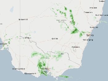
The Southern Annular Mode sat in positive territory through early June 2026, pushing Southern Ocean swell belts south and reducing groundswells reaching SE-facing coasts - but BOM data shows the SAM returning to neutral in late June, opening the peak winter swell window.
El Nino (Nino3.4 index at +0.92 degrees Celsius as of June 14, 2026) is driving drier, warmer conditions across southern Australia, meaning stronger and more persistent high-pressure ridges after fronts and longer clean offshore windows.
What to watch
Track the high-pressure ridge building behind the cold fronts moving through NSW this week - it opens the best offshore and surf planning window of the winter so far.
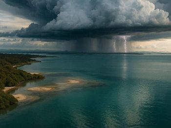
The Southern Ocean's storm belt has shifted back to where winter surfers and offshore fishers need it.
After running in a positive phase through early June - pushing westerly winds south, reducing the swell-generating fetch that reaches SE-facing coastlines - BOM's Southern Hemisphere monitoring data shows the Southern Annular Mode (SAM) index returning to neutral by late June 2026.
Neutral SAM places the Roaring Forties back at their average winter latitude, directly aligned with swell windows for beaches from the NSW South Coast through Victoria, South Australia, and Western Australia's south coast.
What the SAM does to your swell
The Southern Annular Mode is a pressure index that measures whether the Southern Ocean's westerly wind belt has shifted north or south from its average position.
When SAM runs positive, storm systems and swell-generating fetch migrate toward Antarctic latitudes, too far south to effectively build groundswells for SE-facing beaches between Cape Naturaliste (WA) and Merimbula (NSW).
When SAM returns to neutral, those systems re-enter the primary swell window, producing long-period groundswells in the 12 to 16-second range that wrap into south and southwest-facing breaks with power and consistency.
According to BOM's daily SAM monitoring data, the index was positive as of June 13, 2026 and is forecast to return to neutral in late June - a transition already underway as of this week.
"When SAM runs neutral in winter, every south-facing beach between WA and NSW is in the direct path of Southern Ocean swell windows."
El Nino adds a layer: longer clean windows
The El Nino signal running alongside the SAM shift changes the character of the offshore window.
BOM's ENSO monitoring places the Nino3.4 index at +0.92 degrees Celsius for the week ending June 14, 2026, above the El Nino threshold of +0.80 degrees, with all models forecasting continued warming through the year.
El Nino drives below-average rainfall and above-average daytime and overnight temperatures across most of Australia south of the tropics, according to BOM's July-September outlook released in June 2026.
For fishers and boaters, the key point is this: El Nino winters in SE Australia produce stronger, more persistent high-pressure ridges after each cold front, and the settled water that follows clears faster.
Where a La Nina or neutral-ENSO winter might deliver three to four usable offshore days between fronts, an El Nino winter can extend that window to five or six days before the next system arrives.
This is the counterintuitive flip side of El Nino's reputation for drought and heat.
On the water, active Southern Ocean swell from neutral SAM combined with El Nino-extended inter-frontal windows gives SE Australian boaters and fishers more workable days per month than most neutral-ENSO winters.
The high-pressure ridge building behind the two cold fronts forecast to move through NSW coastal waters around June 22-23 - flagged in BOM's Sydney Coastal Waters forecast issued June 18 - is a working example of this pattern in action.
Swell profile: what to expect through July
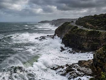
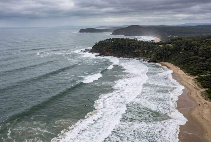
Neutral SAM in mid-winter typically produces alternating southwest to south-southwest groundswells arriving in 2 to 5-day intervals as storm systems cycle through the Roaring Forties.
Long-period energy - 12 seconds and above - bends into south-facing breaks at angles that generate clean, powerful walls suited to mid-lengths, high-performance shortboards, and fish designs at the 2 to 3-metre mark.
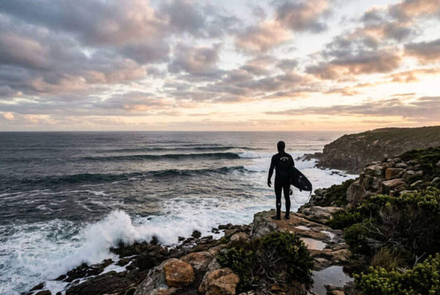
NSW South Coast breaks at Ulladulla, Jervis Bay, and Merimbula face directly into the Southwest swell window and will see the most consistent exposure through July.
Victoria's Surf Coast west of Torquay picks up southwest-to-west groundswells with less southerly shadow, and SA's Fleurieu Peninsula and Yorke Peninsula both sit in open southwest swell exposure with excellent period on winter groundswells.
WA's south coast - the Margaret River to Albany stretch - remains the most direct recipient of Roaring Forties swell regardless of SAM phase, but neutral SAM increases the frequency of events reaching the south coast of the continent as a whole.
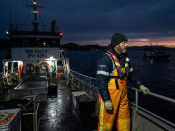
Fishing and diving: windows to plan around
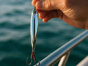
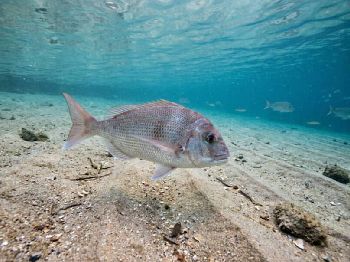
Bottom fishers targeting snapper, blue-eye trevalla, and pearl perch on offshore reefs along the NSW South Coast and Vic's offshore grounds should note the front-then-high sequence as an opportunity, not an obstacle.
Frontal passage stirs baitfish schools along current lines and reef edges; the settling water that follows draws predators up from depth as thermoclines compress.
Kingfish are active in the upper water column along NSW offshore reefs in June and July as water temperatures hold above their feeding threshold - the warm Tasman SSTs running 3 to 4 degrees Celsius above average support this pattern.
For divers, the post-front settling window typically produces the best visibility of the winter period - 10 to 15 metres on rocky reefs that ran murky during frontal passage - making it the optimal window for abalone, crayfish, and reef photography along southern Australian coasts.
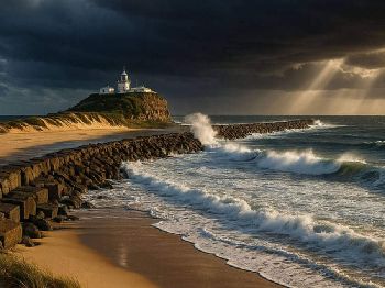
Rip activity is elevated during and immediately after front passage - conditions settle markedly once high pressure establishes, but the 12 to 24 hours after a front clears require extra care at all beach entry points.
Monitor current warnings via NSW marine warnings and build your plan around the high-pressure ridge, not the front.
Planning your July window
The classic winter mistake is departing into a good window and being caught by the early edge of the next front on the return leg.
Check the 4-day marine forecast - any developing low to the southwest within 72 hours of your intended return is a reason to shorten the trip or delay departure until the next high.
Swell period is a more reliable leading indicator than height alone: when long-period energy above 14 seconds begins arriving from the SSW, the generating storm is typically 24 to 36 hours behind it.
The combination of neutral SAM-driven swell consistency and El Nino-extended inter-frontal windows makes July 2026 one of the better planning environments for offshore SE Australia in several years.
Check the Seabreeze wind forecast for Sydney, Melbourne, and Adelaide and build your offshore plan around the high-pressure pattern that follows each front through July.
FAQ
What is the SAM and why does it affect SE Australian surf? The Southern Annular Mode measures the north-south position of the Southern Ocean's westerly wind belt - positive phase pushes swell belts south, away from SE coasts; neutral brings them back into the primary swell window.
Does El Nino make the swell worse in winter? El Nino does not suppress Southern Ocean swell - the Roaring Forties continue generating groundswells regardless of ENSO phase - but it does produce longer, cleaner windows between swell events, which is a positive for offshore boating and fishing.
Which breaks see the most benefit from neutral SAM? South and southwest-facing beaches in NSW's Illawarra and South Coast, Vic's Surf Coast, SA's Fleurieu and Yorke Peninsulas, and WA's south coast all benefit directly from the neutral SAM swell window.
How do I know when the next front is coming? Long-period swell (14 seconds and above) arriving from the SSW is typically 24 to 36 hours ahead of the wind system that generated it - that is your most reliable advance warning when the forecast is uncertain.