Sydney's Warmest June Run Since 1919
In short
Sydney has recorded 10 consecutive June days above 20C, the longest run since 1919, driven by a Tasman Sea high blocking winter fronts and pulling warm air from the north.
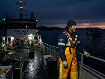
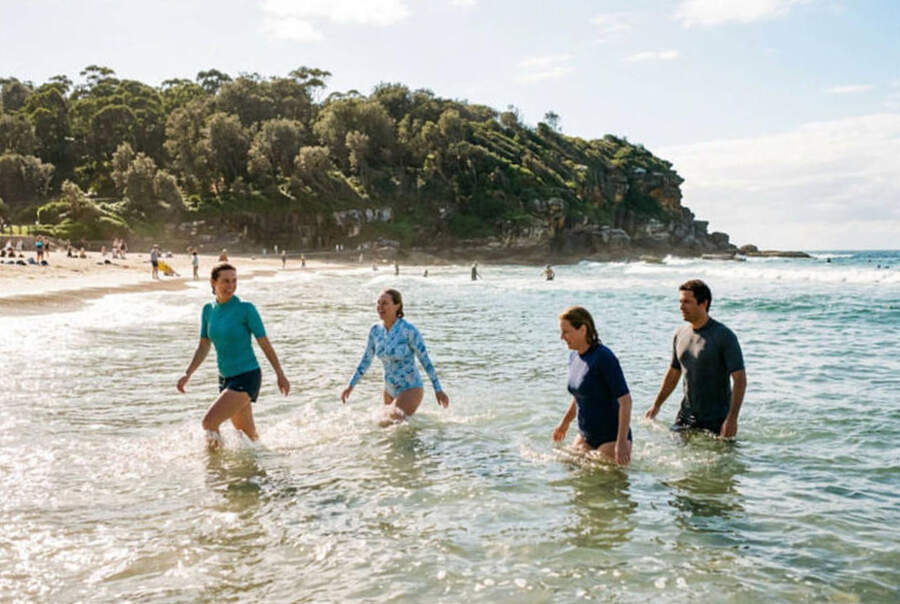
Sea surface temperatures off NSW are running slightly above average. Conditions for boating, fishing, and diving have been pleasant through the week.
What to watch
A developing El Nino is expected to amplify the warm, dry pattern through spring - check the Seabreeze forecast before each session, as individual wind events can still arrive quickly.
Sydney has broken a June temperature record that stood for more than a century.
Temperatures at Observatory Hill topped 20C on Tuesday for the 10th consecutive day - a streak for June not seen since 1919, when records at that station began their second decade.
The average June maximum at Observatory Hill is 17C, based on 167 years of records.
Bureau of Meteorology spokesperson Casey McCarthy confirmed the record, saying it was the unusual duration rather than individual temperatures that stood out.
"It's not unusual to get a day or two above 20C in June in Sydney but what's unusual is to have them for this prolonged period," McCarthy said.
"My antennae went up pretty quickly once I saw we had three or four days."
What's driving it
The mechanism is a blocking high over the Tasman Sea to the east of the continent.
That system is pulling warmer air down from the north while deflecting the cold fronts that typically chase one another across southeast Australia in June.
Sea surface temperatures off the NSW coast have also been running slightly above average, McCarthy said, drawing moist air that is "more typical of autumn" onto the coast.
Nights have been warmer than usual too.
Forecasters had Wednesday at 22C, Thursday and Friday both tipping 23C, with a possible return to 20C over the weekend.
If the forecast holds, McCarthy said Sydney could finish the warm spell with a record 14 consecutive June days above 20C.
"Beating a longstanding record, not by a small amount, suggests something is changing. And that is CO2."
The pattern is not confined to Sydney
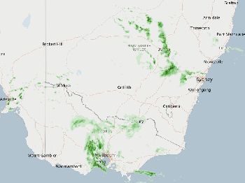
Southeast Australia has been running warm across the board.
Canberra is on track for 11 consecutive days above 15C, against an average of 12C.
Melbourne has already recorded eight days above 17C when the average maximum sits at 14C.
Adelaide has gone through eight days above 17C, and Hobart is looking at a nine-day stretch above 15C against an average of 12C.
"This pattern is pretty consistent across most of south-east Australia," McCarthy said.
Symbolic of the lack of winter cold, ski fields across the Snowy Mountains are sitting bare as June reaches its midpoint.
El Nino in the picture
The Tasman High event is not directly caused by El Nino, but an El Nino is developing in the tropical Pacific - the first since spring 2023.
Bureau senior climatologist Felicity Gamble said in early June that models were "really aligning now" around a likely transition to El Nino during winter.
The World Meteorological Organization put the probability of an El Nino establishing before November at 90 per cent.
During El Nino years, nine of Australia's 10 driest winter-spring periods on record have occurred, according to Bureau data.
For east coast boaters and anglers, that combination of warmer water and reduced rainfall typically means clearer inshore conditions through winter - but also a drier, lower-flow season heading into spring.
What it means on the water now
The immediate picture for NSW is unusually good.
Warmer-than-average sea surface temperatures are keeping pelagics - particularly yellowtail kingfish and bonito - active at shallower depths than they would be in a typical June.
Rock fishers, shore-based anglers, and kayak paddlers are operating in comfortable conditions without the sharp southerlies that usually arrive with each front passage.
Calm mornings have been consistent at Sydney-area boat ramps including Sylvania Waters, Roseville, and Akuna Bay, with the blocking high suppressing the overnight drainage winds that can catch mariners out.
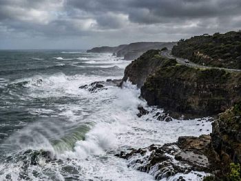
Divers on Sydney's south and north headland reefs are reporting extended visibility windows, with swell suppressed by the easterly high.
Prof Andy Pitman, climate scientist at the University of Sydney, welcomed the pleasant days but added context that resonated beyond comfort.
"I haven't put the heating on in our house yet," he said, before adding: "Beating a longstanding record, not by a small amount, suggests something is changing. And that is CO2."
Planning your sessions this week
The Tasman High is not a permanent fixture.
Frontal systems will eventually break through, likely with brief but sharp wind increases as the pattern re-establishes.
Check the wind forecast before every launch - the current calm is exceptional and should not be taken as the new baseline.
For offshore trips, keep an eye on the Seabreeze Sydney wind forecast and the NSW marine warnings page, which will be the first indicator when the blocking high shifts.
Frequently asked questions
Is it safe to go offshore near Sydney this week? Conditions have been unusually benign, but check the forecast and warnings before every trip - conditions can change within hours once a front approaches.
Are the warm temperatures affecting fish behaviour? Yes. Warmer SSTs are keeping species like kingfish and bonito active closer to shore than usual for June, and baits and lures in the surface-to-mid-water column are producing well.
Will this warmth affect the surf? The Tasman High is generating small to moderate easterly swell in the 1-1.5 metre range on exposed Sydney beaches - clean but modest. More pronounced swell will return when fronts resume.
How long will the warm run last? Bureau forecasts suggest at least mid-week conditions remain above average, but beyond that the pattern depends on whether the Tasman High holds its position.
Does this mean El Nino is here? El Nino conditions are developing in the tropical Pacific but are not yet fully established. The Bureau expects a formal El Nino declaration during winter. The current warmth is related to but separate from that signal.