QLD: Southerly Window Opens Mid-Week
In short
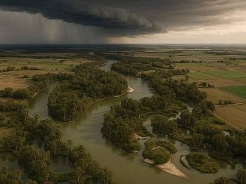
The unseasonal rain band that drenched SE Queensland last week is moving offshore Monday, opening a 48-hour window of drier conditions from Tuesday.
Southerlies moving in behind the band will keep mornings cool - down to 6C in Brisbane's western suburbs - and offshore conditions manageable for short passages.
What to watch
Showers redevelop along the coast from Thursday, so plan launches and passages for Tuesday or Wednesday if you're in SE Queensland.
Queensland's run of unseasonal winter rain is on the way out.
The Bureau of Meteorology confirmed the rain band that brought well-above-average June falls to south-east Queensland will move offshore Monday, leaving drier and cooler conditions through Tuesday and Wednesday.
For coastal users in SE Queensland, the window matters: two days of more settled conditions before the next trough arrives from Thursday.
"The rain band is expected to move off the coast from Monday lunchtime," Bureau of Meteorology forecaster Jonathan Howe said.
"We will be left with just a couple of lingering showers and sunshine by the afternoon right across the south-east."
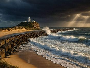
What the southerly means on the water
Southerly winds moving in behind the departing rain band will be the dominant feature for coastal Queensland this week.
Post-frontal southerlies in June typically run 15 to 20 knots out of the south-southeast along the Moreton Bay coast, with the bay itself offering reasonable shelter on its western shores.
Moreton Bay passage planning should target the Tuesday window, with winds easing to 10-15 knots as the high establishes behind the front.
The Gold Coast broadwater and Jumpinpin channel are workable Tuesday, though bar crossings on the Tweed and surrounding bars will remain subject to the residual swell generated by last week's system.
Sunshine Coast offshore grounds - the shelf break sits roughly 40 nautical miles east of Noosa - will see calmer conditions mid-week before southerlies freshen ahead of the next trough.
"The mornings will cool down just a touch, still double digits for Brisbane, but some of the western suburbs, including Ipswich, will be dropping down to 6 degrees on Tuesday."
That is BOM's Jonathan Howe on the post-frontal chill moving across SE Queensland this week.
Morning conditions and the winter bite
Cooler air temperatures tracking into SE Queensland behind the front will push overnight lows down sharply in some areas.
Brisbane proper will hold in double figures overnight, but Ipswich and the western suburbs are forecast to reach 6C on Tuesday, according to Jonathan Howe at the Bureau of Meteorology.
Inland Central Queensland will feel it harder - Biloela is forecast to drop to 5C on Wednesday morning - but coastal areas will be buffered by residual sea-surface warmth.
For fishers, the cooling air behind a rain band typically coincides with a period of clearing water and improved estuary activity.
Estuary species like bream and flathead tend to become more active in the days immediately after a frontal passage, as water clarity improves and baitfish schools consolidate around structure.
North Queensland: different story
The pattern that delivers a window to SE Queensland does not extend to the tropical coast.
North of Ingham and Cairns, south-easterly showers along the tropical coast will continue through the entire week.
"We did see some pretty moderate totals over the last week, but just sort of those typical south-easterly showers along the tropical coast, and that will continue all through the week, so very little change through there," Howe said.
The Whitsundays, Mackay and Townsville will have the best of it in the north - a mostly dry week ahead that suits island passage planning and offshore reef fishing.
Coral Sea conditions from Cairns northward will remain influenced by the persistent south-easterly trade wind pattern.
The bigger picture: El Nino overhead
The unseasonal June rainfall that preceded this week's dry window is part of a transitional pattern playing out as El Nino strengthens overhead.
The Bureau of Meteorology officially declared an El Nino active in the Pacific on June 17 - the first such declaration in almost three years.
"El Nino adds to all of those [existing risks], so increases the risk even further of having heat, drought, fire weather and coral bleaching as well," said Andrew Watkins, Monash University adjunct professor and climate councillor.
Modelling suggests this El Nino could become the strongest in the modern era, with central Pacific sea surface temperatures potentially exceeding 3 degrees Celsius above average, according to Bureau of Meteorology long-range forecasts.
For Queensland water users, the practical implication is a drier, warmer second half of 2026 - with more frequent offshore windows and warmer sea surfaces through spring and summer.
Below-average rainfall is forecast across parts of southern and eastern Australia from July to September, based on the Bureau of Meteorology's current long-range outlook.
What to expect this week
The clearest window for SE Queensland water users runs from Tuesday morning through Wednesday afternoon.
Showers are expected to return along the coast from Thursday, with the south-east likely to see wet weather through the weekend.
"Very, very patchy showers could develop later this week and into the weekend, but no big rain systems," Howe said, adding that any significant system is "potentially something early next week, but that's still quite a way out."
Gulf Country and inland regions will largely remain dry through the week, with only patchy shower possibilities on Friday.
For Central Queensland - Rockhampton to Emerald - conditions will mirror the south-east: a dry mid-week before showers return later in the week.
Your window this week
SE Queensland (Moreton Bay, Gold Coast, Sunshine Coast): Tuesday-Wednesday is your window. Bar crossings subject to residual swell from last week's system - check before you launch.
Whitsundays and Central QLD coast: Best part of the week. Dry conditions through most of it.
Tropical coast (north of Ingham): Persistent south-easterly showers, limited offshore options.
Track the latest conditions via Seabreeze Queensland wind forecasts .
FAQ
Is the southerly wind good or bad for fishing this week? A fresh southerly typically brings clear water to SE Queensland estuaries and activates bottom-feeding species. Offshore passages are manageable in the 15-knot range but check bar conditions before launching.
When do showers return to SE Queensland? Bureau of Meteorology forecasts have showers redeveloping along the coast from Thursday, continuing through the weekend.
Will it be warm enough to swim mid-week? Air temperatures in the mid-teens to low 20s are expected through the day. Sea surface temperatures around Moreton Bay and the Gold Coast typically sit around 18-19C in late June, so it is cool but not cold for the water.
Is this El Nino going to make the rest of winter drier? The Bureau of Meteorology's long-range outlook points to below-average rainfall across parts of eastern Australia July-September. More settled conditions and more offshore windows are the likely result for water users through the rest of winter.