

Record High Stalls: Calm Seas, Lower Tides

In short
A stalled blocking high over Tasmania shattered Australia's all-time air pressure record on Monday, reaching 1044.5 hectopascals at Ouse - 58 years after the previous mark.
Sea levels across south-eastern Australia are running 20-30cm below normal as the intense high pushes the ocean surface down.
What to watch
The high should drift off Tasmania's east coast by Friday, ending the exceptional calm window for Bass Strait and southern coastal waters.
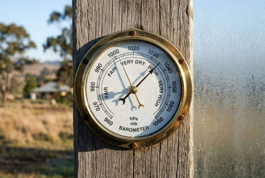
At 9:50am on Monday, a weather station at Ouse, 67 kilometres north-west of Hobart, logged an air pressure of 1044.5 hectopascals.
That reading ended a record standing since June 7, 1967, when Launceston reached 1044.3 hPa.
The driver is a blocking high that tracked through the Great Australian Bight on Saturday before stalling completely over Tasmania, allowing pressure to pile up over a single location to an abnormal degree.
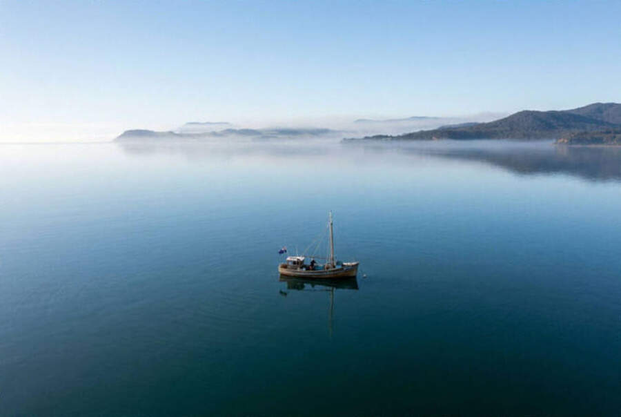
For water users across south-eastern Australia, the knock-on effect is immediate: Bass Strait and the waters off Victoria, Tasmania, and southern New South Wales are running glassy under light to variable winds.
What the pressure drop does to the water
High pressure pushes the ocean surface down.
Each extra hectopascal of pressure reduces sea level by roughly one centimetre - the reverse of what a tropical cyclone does when low pressure drives a storm surge inshore.
With this high running 20-30 hPa above the seasonal average, sea levels across south-eastern Australia are sitting approximately 20-30 centimetres below a typical July reading, according to Bureau of Meteorology data.
Boaters launching from shallow ramps should factor in that offset - a ramp that clears comfortably at mid-tide may need a higher-water launch this week.
Dry-stack operators and shallow-draft trailer boaters working protected bays from Portland around to Bicheno should treat predicted tide heights conservatively and add 20-25 centimetres to any minimum underkeel requirement.
"Given that we are in school holidays, if anybody's thinking of heading to the south-east coast over the next day or two, just keep an eye out that there will be some hazardous surf around."
That warning from Bureau of Meteorology senior forecaster Felim Hanniffy applies to the Queensland coast between K'gari and the Sunshine and Gold Coasts, where southerly winds wrapping around the eastern edge of the high are generating hazardous surf.
Surf is forecast to remain dangerous through Tuesday and potentially into Wednesday.
 Bass Strait and the offshore window
Clear skies and light winds under a stalled high create some of the best offshore conditions of winter.
Bass Strait crossings from Queenscliff, San Remo, and Port Welshpool look workable mid-week, with coastal swell running well below the July average under the settled pattern.
On the Tasmanian side, St Helens, Bicheno, and Triabunna offer sheltered launches for reef fishing - good visibility conditions for working soft plastics over structure and squid in the shallows after dark.
The trade-off is cold. Liawenee in central Tasmania recorded a minimum of -8.1 degrees Celsius on Monday morning, with Ouse dipping to -5.5C.
Inland of Melbourne, Coldstream reached -2.7C and Tullamarine Airport touched 0.1C - frost conditions extending through at least Tuesday night across most of Victoria and southern New South Wales.
Water temperatures in the shallows will fall with each successive clear, still night, which tends to move bream and flathead away from weed edges and onto deeper structure.
The longer climate signal
Monday's record is not a one-off.
Bureau data since 1950 shows a clear upward trend in both the frequency and intensity of high-pressure systems over southern Australia, a pattern tied to the expansion of the Hadley Cell.
The Hadley Cell is the atmospheric circulation that drives air upward near the equator before it spreads poleward, cools, and sinks.
In a warming world, that sinking column reaches further south and pushes the high-pressure belt deeper into southern Australia, producing events like this week's record more often.
A comparable system brought readings near 1044 hPa just two years ago, according to Bureau of Meteorology records.
When it clears
The high should begin tracking off Tasmania's east coast by Friday, ending the settled spell for southern waters.
A southerly change in its wake is likely to kick up short-period swell across Bass Strait over the weekend, so the Tuesday-through-Thursday window is the pick for offshore runs and longer coastal passages.
Track conditions and check the latest warnings via the Victorian marine warnings and the Melbourne wind forecast on Seabreeze.
Q&A
Will the lower sea level affect my ramp launch? Yes - add 20-25cm to your minimum depth requirement this week at any shallow or tidal ramp.
How long do the calm conditions last? The high stalls until Friday. Tuesday through Thursday are the best mid-week windows for southern waters.
Is a pressure reading above 1044 hPa rare? Extremely - it has only been recorded twice in Australian history, and both events happened within the last two years.
What about the Queensland hazardous surf? Conditions there should ease from Thursday as the southerly pulse moderates with the high moving east.
What does a blocking high mean for fishing? Calm seas and clear visibility are ideal for lure work over structure and for overnight squid sessions in the shallows.

 Mandurah, WA









 Foiling - Foils Complete